This article may contain affiliate links.
Updated: March 3, 2026
In this article, you’ll find several maps of Khao Sok National Park: a general map, a map of Cheow Lan Lake, and hiking trail maps through the jungle. They’ll help you get oriented, explore the routes, and decide which area you want to visit.
If you’d like more details, check out my Khao Sok guide where you’ll find everything about what to see, how to get there, how to get around, where to stay, and plenty of practical tips.
Maps
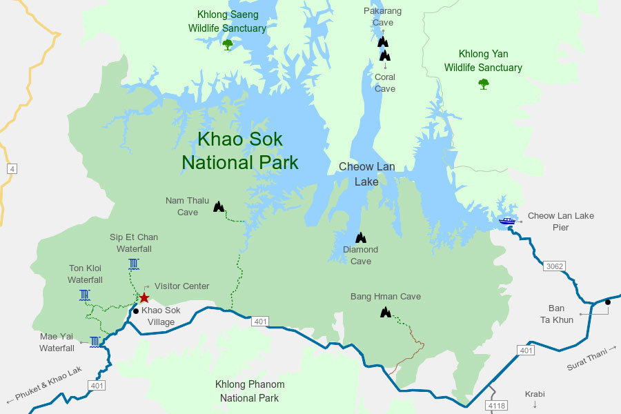
1. Khao Sok National Park
This map shows the main points of the park — from the Visitor Center at the entrance and the lake pier to the most popular caves and waterfalls.
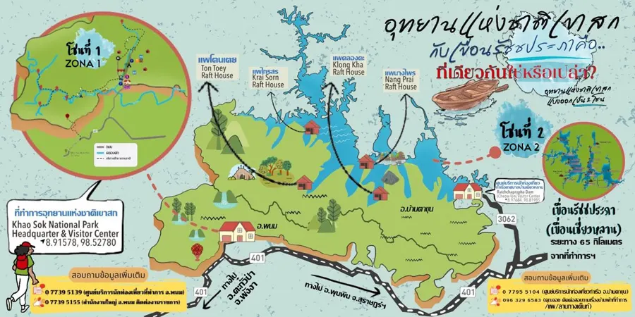
2. Areas of Khao Sok
The park is divided into two main areas: the tropical rainforest and Cheow Lan Lake. This map will help you get a better sense of how it’s laid out.
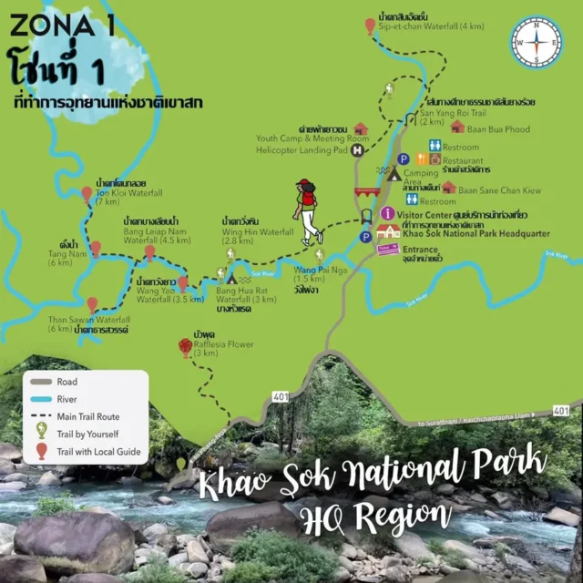
3. Jungle
Here you can see the main hiking trails with their distances. It also marks which routes can be done independently and which require a guide.
From my experience, you can hike all of them on your own, but it’s still best to check at the Visitor Center when you arrive.
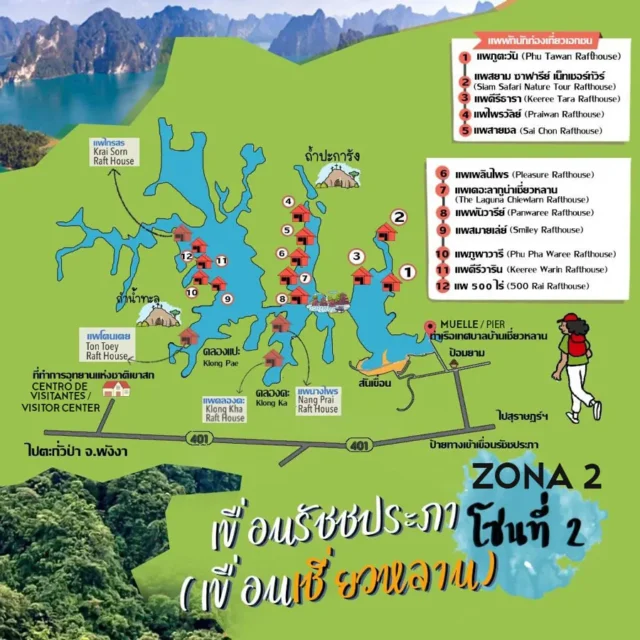
4. Cheow Lan Lake
This map shows the lake area with the Visitor Center, the road to the pier, and the location of the floating bungalows.
Best tours to Khao Sok
Public Transportation
Final Thoughts
I hope these Khao Sok maps help you plan your trip and make the most of one of Thailand's best national parks.
If you have any questions, leave me a comment below and I'll help you as much as I can. If you found the article useful, share it with other travelers. Have a good trip! 😘
More about Southern Thailand


Hi, I’m Andrea, creator and author of Viajeros Activos (Active Travelers). I write about Southeast Asia, the Caucasus, and Europe. I’m a full-time traveler, passionate about good food, and always looking for new adventures.